
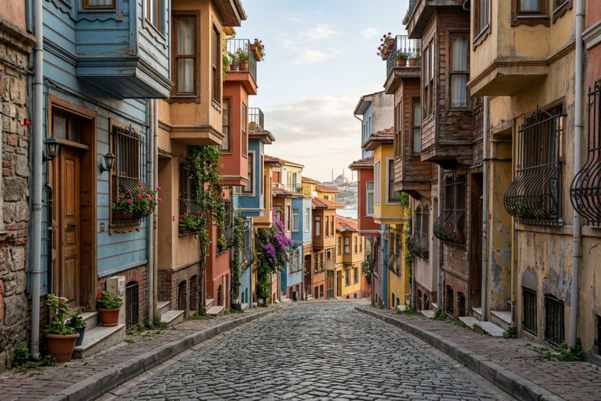
Istanbul historic neighborhoods unfold like a palimpsest: street patterns, building details and public spaces all record changes across centuries. If you want a deeper, non-touristy understanding of the city's development, this guide shows how to read those layers on foot, with practical routes, key visual cues and timing advice to maximize what you see.
Istanbul historic neighborhoods: how to read the city's layers
Start by noticing contrasts: narrow winding alleys versus broad rectilinear boulevards, modest timber houses alongside stone facades, and the placement of markets and civic buildings. These contrasts map to distinct historical moments — Byzantine urban cores often orient around fortifications and churches, while Ottoman quarters pivot toward külliyes (social complexes), hans and organic residential clusters.
Reading these traces requires slowing down. Pause at thresholds, watch where streets end or open into small squares, and look up for cornice lines, timber balconies and reused spolia in masonry. Over time, this habit will let you distinguish a 16th-century street rhythm from a 19th-century commercial artery, turning each of your walking tours into a mini-lesson in urban history.
Three layered walking routes by era
Below are three curated walks that emphasize different eras and what they left in the urban fabric. Each route is intended for a relaxed half-day pace and highlights both obvious monuments and lesser-known markers.
Byzantine core: walls, processional axes and hidden chapels
Focusing on the Fatih and Sultanahmet districts, begin near the old city walls and follow streets that run parallel to them; these axes were often the backbone of processions and market lines. Look for surviving stonework, reused columns in façades, and small, tucked-away chapels converted over time. These features reveal how sacred and defensive priorities shaped the street grid. Explore more about this era in our Byzantine heritage guide.
Bring a magnifying habit: inscriptions, capital designs and irregular paving tell stories of repair and reuse. A slow walk here rewards you with moments where the ancient and medieval overlap in a single threshold.
Ottoman neighborhoods: hans, külliyes and courtyard life
Shift to an Ottoman quarter like Eminönü or Süleymaniye, where a mosque complex anchors daily life. Instead of focusing on the mosque interior, observe adjacent hans (caravanserais), bathhouses and the arrangement of narrow service alleys. The spatial logic here connects domestic life, commerce and charitable institutions. Learn more about Ottoman architecture to identify these structures easily.
Pay attention to courtyards and rear façades: large timber windows, enclosed gardens and architectural solutions like cumbas (bay windows) and covered arcades demonstrate how residents adapted architecture to social privacy and environmental needs.
19th–20th century zones: boulevards, embassies and industrial traces
In districts like Beyoğlu and Galata, transformed during the 19th and early 20th centuries, you’ll find planned boulevards, consular buildings and former factories. These areas express modernization: wider streets, aligned façades, and mixed-use plots with shopfronts below apartments.
Notice material shifts — cast iron, patterned brickwork and glazed tiles — that mark a different construction logic and a growing global influence on Istanbul’s architecture during the late Ottoman and early Republican periods.
What to look for: architectural and urban cues
Knowing which details to scan for makes short walks far more informative. Below are recurring cues and what they typically indicate:
- Reused columns or spolia — often signal an earlier monumental structure on the same site, common in Byzantine-to-Ottoman transitions.
- Orientation of façades — grand façades facing squares usually belong to civic or religious institutions, while inward-facing buildings suggest courtyard living.
- Layered shopfronts — changes from stone arches to cast-iron frames expose shifts in commerce and technology.
To summarize visually, the short table below helps you match a visible cue to probable era and its interpretive meaning.
| Visible Cue | Likely Era | What it Suggests |
|---|---|---|
| Reused stone columns | Byzantine / early medieval | Earlier sacred/site continuity |
| Courtyard hans | Ottoman | Trade networks, lodging for merchants |
| Aligned boulevards | 19th–20th c. | Modern urban planning and state reforms |
Practical timing, logistics and respectful exploration
Plan walks in the morning or late afternoon to avoid heat and to watch daily life unfold. Weekdays show commercial rhythms, while weekends reveal a different social energy. Use public transport to reach starting points; many historic areas are best experienced on foot once you arrive.
Respect private life by avoiding intrusive photography of people and private courtyards. If you want to enter a historic building that still functions as a residence or workplace, ask politely; many owners will gladly share a story. Carry cash for small donations, local cafés and entrance fees to lesser-known sites.
"A neighborhood is not just a collection of buildings; it is the record of how people lived, worked and reshaped a place over centuries."
Summary and next steps
Reading Istanbul historic neighborhoods on foot turns familiar sights into a narrative of change — from fortifications and chapels to hans and modern boulevards. Start with one of the three routes above, focus on material and spatial cues, and let each street reveal its own chronology.
Ready to plan your next walk? Explore more detailed maps and neighborhood profiles on our historic districts page to tailor a route to your interests and timing. Share your favorite discovery after your walk and help other readers see Istanbul's layers with fresh eyes.